Upper Animas
Conquering the Upper Animas: An Epic Whitewater Adventure in Durango, Colorado
Are you a Class V-seeker craving an unforgettable adventure? Look no further than rafting the Upper Animas in Durango, Colorado. This legendary stretch of river is not for the everyone, but for those who crave heart-pounding rapids and stunning mountain scenery, it's an experience that will stay with you forever.
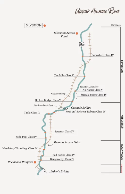
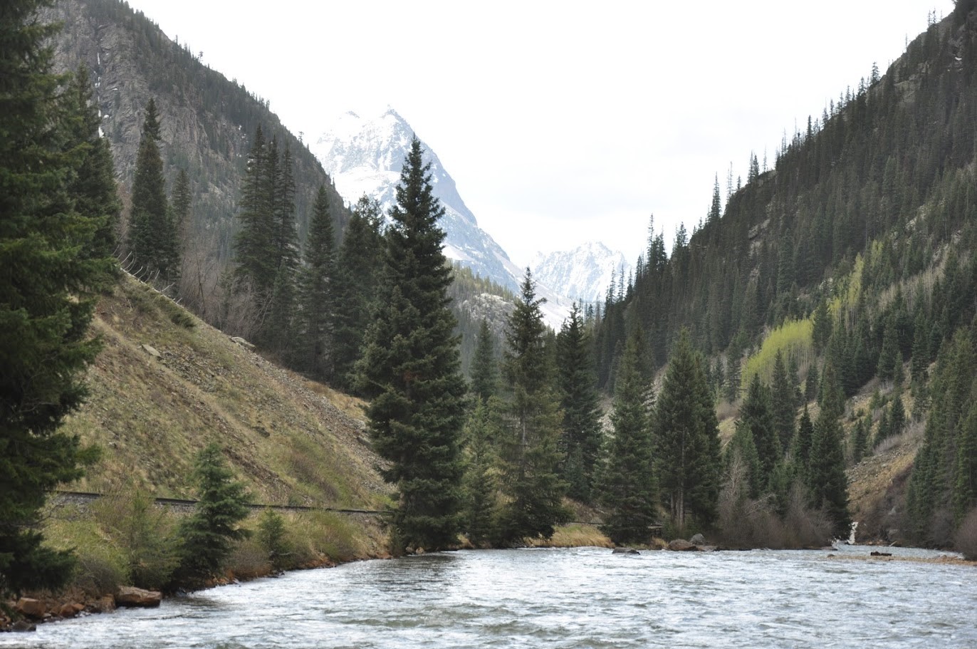
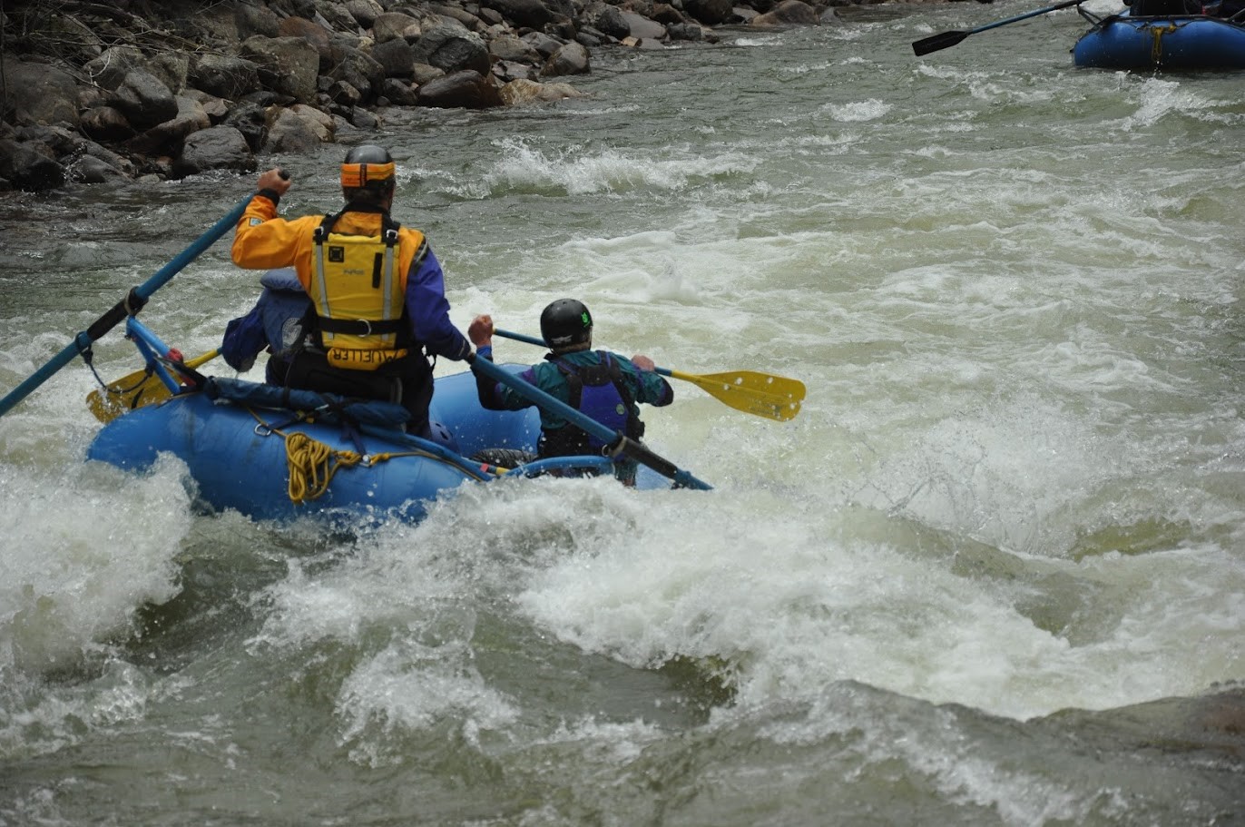
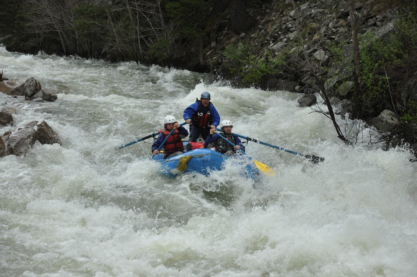
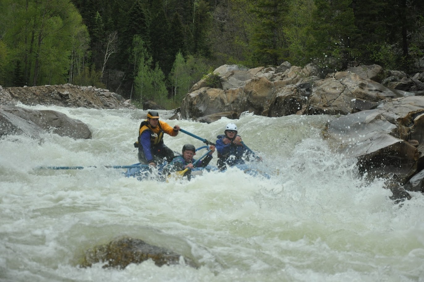
The Upper Animas is no lazy river cruise. Nicknamed one of the most challenging whitewater sections in the US, it carves its way through the heart of the remote Weminuche Wilderness. Imagine continuous stretches of Class III and IV rapids, with three Class V rapids depending on the water flow, and an average gradient drop of 85 feet per mile. Be prepared to get wet, paddle hard, and experience the exhilaration of navigating technical whitewater.
The remoteness of the Upper Animas adds another layer to the adventure. Many rafters incorporate a ride on the historic Durango & Silverton Narrow Gauge Railroad, to transport gear for camp and to exit the canyon at Tacoma Power Plant as any exit after this point would require a steep hike out. This iconic train journey adds a touch of nostalgia to the trip, transporting you back in time as you chug alongside the roaring river.
The Upper Animas season is short, typically running from late May to mid-July. Due to the difficulty of the rapids, most outfitters require prior rafting experience and a pre-trip orientation. Be prepared for a full day commitment, with plenty of paddling and maneuvering. My personal favorite levels are between 800-1400 cfs.
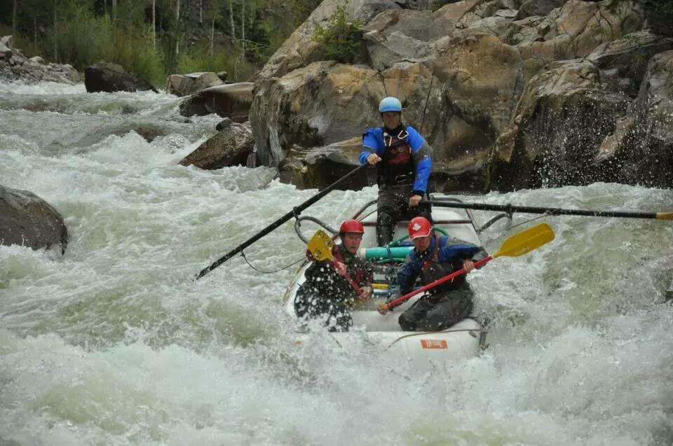
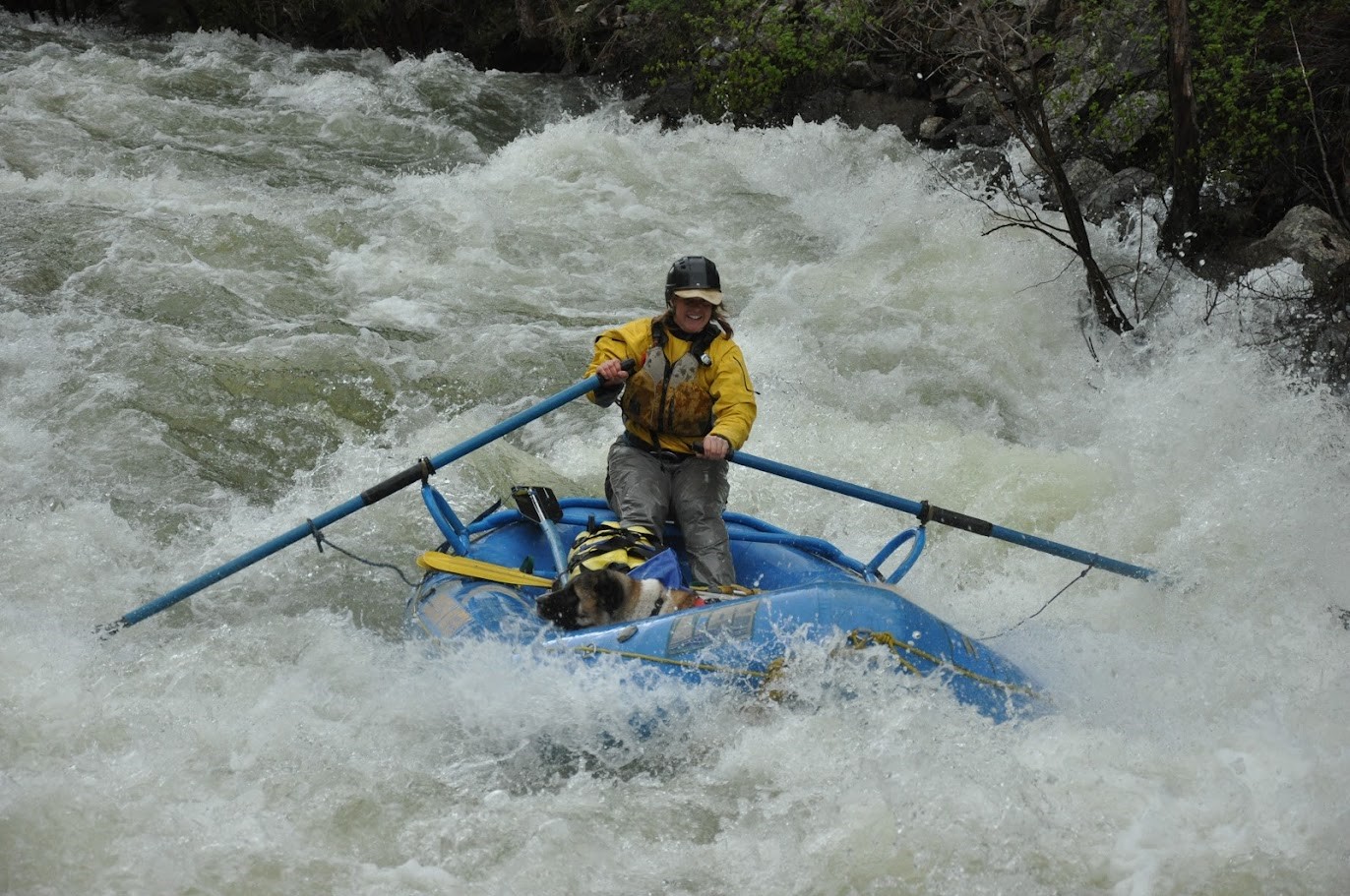
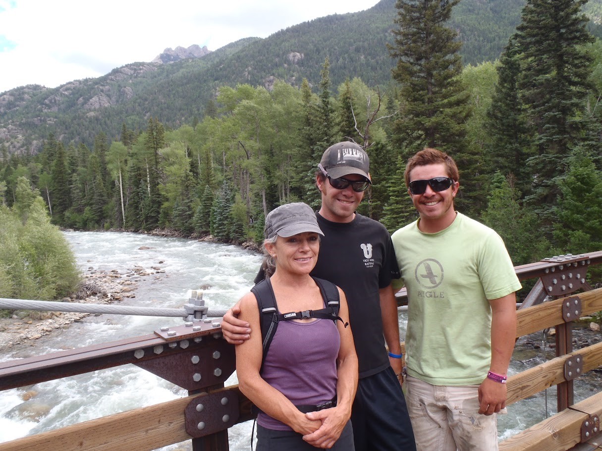
The Upper Animas is no place for the unprepared. Strong swimming skills and a good level of physical fitness are essential. Most outfitters will provide all the necessary rafting gear, including wetsuits, life jackets, helmets, and paddles. Whether you are going on your own trip or with a company I would suggest a two day trip using Needleton as your base camp. While the whitewater is the undeniable star of the show, the Upper Animas also boasts breathtaking scenery. Towering peaks pierce the sky, and the lush wilderness provides a stunning backdrop to your adventure. Keep your eyes open for wildlife sightings, you might spot deer, bighorn sheep, or even the occasional bald eagle soaring overhead.
If you're looking for a relaxing scenic float, this is not the trip for you. But if you crave an adrenaline-pumping adventure that will test your limits and leave you with bragging rights, then the Upper Animas is an unforgettable experience waiting to happen.
Quick Facts
- Section Length: 24.9 miles (excludes Rockwood Gorge)
- Diffculty: IV-V
- Typical Season: Late May-Mid July
- Typical Peak: Late May-Early June
- My ideal water flows: 800-1500 CFS below Silverton
Notable Rapids
- Snowshed
- Ten Mile
- No Name
- Broken Bridge
Favorite Campsites
- Needleton
The Upper Animas River in Durango, Colorado boasts a rich history intertwined with glaciers, mining, and daring exploration
The story begins millions of years ago during the Ice Age. Massive glaciers sculpted the dramatic canyon landscapes we see today. The Animas River itself was shaped by a colossal glacier that stretched for miles, leaving behind a powerful waterway as it retreated [1].
For centuries, the Animas River served as a vital resource for indigenous people. While details are scarce, we know it played a role in the lives of those who inhabited the region long before European arrival [2].
Spanish explorer Juan Maria de Rivera bestowed the name "Rio de las Animas" (River of Souls) on the waterway in 1765 [4]. The exact origin of the name is debated. Some believe it refers to the souls lost while crossing the river, while others suggest it might be a mistaken association with another river [1, 3].
The 1870s saw the arrival of prospectors, forever changing the face of the Upper Animas. Silverton, a prominent mining town, thrived due to its location on the river. The mining activity left its mark on the landscape and even impacted the water quality at times [2].
For much of its history, the Upper Animas remained largely unexplored by thrill-seekers. The challenging rapids discouraged casual attempts. It wasn't until 1981 that Wayne Walls, a rafting company owner, pioneered the first commercial rafting trip down this section using a helicopter to scout the route [4]. This daring feat opened the door for a new wave of adventurers to experience the Upper Animas' whitewater wonders.
Today, the Upper Animas continues to be a treasured resource. Rafting companies offer guided trips, allowing visitors to experience its wild beauty and challenging rapids while respecting its historical significance.
Sources
- [1]: Animas River | Colorado Encyclopedia [coloradoencyclopedia.org]
- [2]: Animas River - San Juan Citizens Alliance [sanjuancitizens.org]
- [3]: The Animas River — A Tale of Untamed Resilience - Mild To Wild Rafting [mild2wildrafting.com]
- [4]: The Origins of Rafting The Notorious Upper Animas River [mild2wildrafting.com]
The Upper Animas River in Colorado boasts a fascinating geological story, shaped by volcanic activity, ancient seas, and powerful erosional forces.
The most prominent aspect of the Upper Animas' geology is its volcanic past. Millions of years ago, the area was home to a massive caldera, a cauldron-shaped depression formed by the collapse of a volcano [1, 2]. Volcanic eruptions spewed ash, lava, and cinders, which solidified over time to form the foundation of the landscape we see today. These volcanic rocks, known as the Silverton Volcanics, are prominent throughout the region [2].
Before the volcanic activity, the area was covered by a shallow sea. Over millions of years, sediment from eroded mountains and the remains of marine organisms accumulated on the seabed, eventually compacting into sedimentary rocks. These Paleozoic and Mesozoic sedimentary rocks are exposed in some areas along the Animas River downstream of Silverton [1]. The Ignacio Quartzite, a particularly resistant layer, forms a dramatic presence in some sections [1].
The intense heat and pressure associated with volcanic activity caused some of the pre-existing rocks to undergo metamorphism. This process transformed the original rock into new minerals, often resulting in harder and more stable formations. Chlorite, epidote, and calcite are some of the minerals formed through this process [1].
The dramatic canyons and valleys carved by the Animas River are the result of relentless erosion. Over time, glaciers, rivers, and weathering forces relentlessly reshaped the landscape. The powerful flow of the Animas River continues to erode the rock formations, shaping the riverbed and contributing to the whitewater rapids so famous in the Upper Animas [2].
The unique geology of the Upper Animas plays a significant role in the environment we see today. The mineral content of the rocks influences the water chemistry, and the presence of abandoned mines can impact water quality in some areas [3]. Understanding the geological history provides valuable insights for responsible management of the river's ecosystem.
Sources
- [1]:Generalized Geologic Map of the Upper Animas River Watershed and Vicinity, Silverton, Colorado
- [2]:Draft HRS Documentation Record Reference 8, USGS Professional Paper 1651, Integrated Investigation of Environmental Effects
- [3]:Animas River | Colorado Encyclopedia
Trips Run: Guiding & Safety Kayaking for Mild to Wild
This section of whitewater was certainly one of the most challenging and rewarding sections of whitewater I had the privilege of guiding. During this time and in this area I also made lifelong lasting friendships with the guides at Mild to Wild and Mountain Waters. One of the amazing aspects of running these trips was that it was generally run as an overnight where you started in Silverton, Colorado camped in Needleton, and took the train out to Rockwood station. For many of these trips, Mountain Waters was also guiding trips down so we often ran safety for each other in the class V drops and camped across the river in Needleton. While it's tough for me to say what happened on each trip as there are hundreds of them, I do have many memories of this section that I will always cherish.
Ten Mile and No Name are scoutable on river right using the train tracks, while Broken Bridge is scouted on the left. If you are not up for running Ten Mile, you can portage on river right along the train tracks and so can No Name. I've never portaged Broken Bridge, maybe you could line it easier.
Due to its technical nature, remote location, and challenging whitewater, I would recommend going on this section with a commercial company or going with someone who knows the section and the logistics of running it. Most commercial guides who run this section train for years on other sections and generally spend a training year up here where they row other guides down running as safety for commercial trips and do a check-out trip with a senior guide on the boat before they are allowed to take commercial guests.
2008
I started to train on the Upper Animas for safety kayaking in 2008, the year I started commercially guiding. Safety kayakers are often used by commercial companies in tougher sections of whitewater due to their speed and maneuverability compared to rafts. If someone falls out of the boat and gets away from the raft a kayaker can assist the swimmer back to the raft or shore. This role can be one of the easiest on the trip when things all go to plan, but when there is action it can be one of the most challenging.
During my first year in 2008, I trained under Dave Farkis alongside Joel Cameron, an extremely talented kayaker and a great mentor who certainly shaped my guiding career and helped me push my abilities to a whole different level. According to my old logs, I ran about 8 trips this year as a safety kayaker.
2009
After spending my year of training under Dave, I started to run as a safety kayaker on my own for trips. During this time many of the guides I was very close with started their training year for guiding boats in this section. Neil Cheesewright, James Foerster, Lange Adams, and Kyle Stewart all were training this year and/or starting to take clients down this section for Mild to Wild, all under the leadership of our friend and mentor Andy Steininger and rafter owner Alex Mickel. Across the river, Mountain Waters had Tessa Johnson, Dave Untenrier, Dave Gentempo, John Dunn, Dave Wolmack, Jesse Mueller & Pally all a seasoned bunch you had been guiding up there for years.
This year was my first year running trips without my trainer Dave and it was exciting to have the responsibility for the safety kayaking responsibilities. I am sure I had some great swimmer saves and certainly several memorable trips. However, watching so many of my friends guide the boats on this glorious section of water, I aspired to do the same. Towards the end of the season, during lower water, I begin taking training trips down making it my first time in a raft on the Upper. All in all, between the rafting and kayaking I logged 15 trips this year.
2010
This year marked my first season mostly in a raft in this section. While I was still doing some safety kayaking, we began to rotate the safety kayaking between myself, Joel, Lange, and James and I was able to check out and begin taking clients. While I don't remember this being a particularly good water year I know we had plenty of trips, some great times and I logged 15 trips that season.
2011
This I certainly remember as it was a very long and big water year. We had an amazing snowpack that year and the late spring and early summer was cool and wet depositing snow through June in the high peaks of Silverton. Our season of boating that year started in May and we didn't finish taking trips until sometime mid-August. One particular trip stands out to me where the gauge was broken (unbeknownst to us) at 1,200 CFS when in actuality it was running over 2,200 CFS out of Silverton. This level is well above what we would normally cut a trip off at and it was an exciting day on the water with lots of swimmers and saves. We made it from the base of No Name Rapid to Needleton in under 10 minutes the water was moving so fast, and we passed the train during this section to the amazement of many train passengers!
We were so busy during this season I didn't track the number of trips, only the number of days in a row I was rafting up there each month. During June I worked 28 days, June was 21 days, and August was 14 days. Taking into account that some of these were one-day trips, and a few 3-day trips with the majority of them overnight, I would say somewhere in the ballpark of 40 trips up there that year.
2011 also marked the departure of our mentor Andy, who returned to school to become a hydrologist. We were both excited for him and sad to see him go, but he had mentored as well and was leaving it for the next generation of young guns.
2012
The 2012 season was an average water year as far as flows go, but it was fairly steady as far as trips go. With such an epic year the season before the crew had solidified and had come to an almost telepathic communication. I also attributed the close connections and bonds to the amount of time we spent with each other under high-intensity situations and how much time we were around each other outside of boating. During this season I also took my Mom and brother (who also had started guiding) on a commerical trip where I rowed them down with a few other clients. That trip will always be a special one as it was the only time I had both my Mom and brother on my boat in this section.
At the end of the season, James and Lange announced they were leaving the company to start their own company Elk Mountain Expeditions (EME) in the Roaring Fork Valley. While we were certainly excited for our friends to move on to bigger and better things, it marked the end of a great era we had on the Upper for our crew.
2013
While 2013 wasn't nearly as good of a water year, we were plenty busy up there. By this time our crew had been boating together on that section for several years together and the crew had mostly stayed unchanged. It was business as usual for the whole season and another good one in the books. I logged around 12 trips that season. One trip that always keeps me smiling is a trip where I took my then girlfriend down on her first class V. Turns out that was a great idea on my part as she is now my wife, Amanda, and has shared many other trips since.
2014
This season was a somewhat changing of the guard with James and Lange having left to start EME and a few other guides following them up to Roaring Fork. Neil, Kyle, and I stayed on and rafted another season up there, and started training James D'Spain, Miles and I'm sure a few others who escape me now. The season was another good one in the books, and I logged about 12 trips that season.
2014 was also my last season of full-time guiding. I had gotten engaged in August of 2013 and I was looking to leave guiding and pursue a new career.
Current Flow Below Silverton
Current Flow At Tall Timber Resort Above Tacoma, CO
River Map